Makó
 |
The climate is warmer than anywhere else in Hungary, with hot, dry summers. The town is noted for its onion which is a hungarikum, the spa and the thermal bath. The Makó International Onion Festival, the largest of its kind, is held annually. Makó is a popular tourist destination in Hungary.
The Makó gas field, located near the town, is the largest natural gas field in Central Europe. The gas volume is more than 600 billion cubic metres (21 trillion cubic feet), according to a report by the Scotia Group.
The town's floodplain forests are protected as part of Körös-Maros National Park.
The economy is based on agriculture. The town is noted for its production of onions and garlic. Both the climate and the soil structure make the town and its surroundings an ideal place for onion farming. Onions have been cultivated in the region since the 16th century. The first records of significant garlic production date to the late 18th century. International recognition of the garlic grown in Makó has been widespread since the Vienna Expo in 1873 and the Brussels Expo in 1888.
The mud of the Maros River has similar properties to some of the best in Hungary and the world; at times it is likened to that of the Dead Sea. The local spa has been one of the main tourist attractions since 1961.
With the political changes in 1989, after the break-up of the Soviet Union, Makó lost jobs in industry. Unemployment has risen in the area, to an estimated 8% in the early 21st century, and is considered a serious issue. Farmers have also suffered more economic difficulties. The town has established an industrial park to encourage that development, and the town hopes to build on its site as "The South-Eastern Gate of the European Union".
Makó has become known in the early 21st century for the nearby Makó Trough, a basin-centered gas accumulation that could be one of the largest natural gas fields in continental Europe. As of March 2007, it was not clear whether the gas can be recovered economically from this area. At the 90% probability rate, Makó had certified recoverable resources of over 600 billion cubic meters of natural gas, according to a report by the Scotia Group. This was prepared for the field's exploration concession holder, the Canada-based Falcon Oil and Gas.
Map - Makó
Map
Country - Hungary
 |
 |
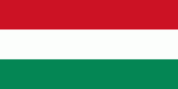
| Flag of Hungary | |
The territory of present-day Hungary has for centuries been a crossroads for various peoples, including Celts, Romans, Germanic tribes, Huns, West Slavs and the Avars. The foundation of the Hungarian state was established in the late 9th century AD with the conquest of the Carpathian Basin by Hungarian grand prince Árpád. His great-grandson Stephen I ascended the throne in 1000, converting his realm to a Christian kingdom. By the 12th century, Hungary became a regional power, reaching its cultural and political height in the 15th century. Following the Battle of Mohács in 1526, it was partially occupied by the Ottoman Empire (1541–1699). Hungary came under Habsburg rule at the turn of the 18th century, later joining with the Austrian Empire to form Austria-Hungary, a major power into the early 20th century.
Currency / Language
| ISO | Currency | Symbol | Significant figures |
|---|---|---|---|
| HUF | Hungarian forint | Ft | 2 |
| ISO | Language |
|---|---|
| HU | Hungarian language |


